

THANK YOU FOR SUBSCRIBING
× 
Applied Technology Review Weekly Brief
Be first to read the latest tech news, Industry Leader's Insights, and CIO interviews of medium and large enterprises exclusively from Applied Technology Review
Applied Technology Review: Specials Magazine

Infrastructure planning, disaster response and risk assessment depend on geographic information that accurately reflects conditions on the ground. Even minor positional discrepancies in aerial and satellite imagery can influence engineering designs, investment decisions and operational planning, making precision essential from the earliest stages of every project. Providing that level of accuracy is where Intermap Technologies stands apart. Combining advanced orthorectification, proprietary elevation data and sophisticated spatial processing, the company transforms raw aerial and satellite imagery into precise geographic intelligence. By supporting organizations where accuracy directly influences outcomes, the company delivers dependable information for accurate planning, analysis and decision making across complex operating environments. Where Accuracy Begins Every aerial or satellite image contains some degree of distortion. Terrain variation, sensor movement, camera angles and Earth's curvature can alter the apparent position of roads, buildings and natural features, preventing imagery from accurately reflecting real world conditions. Left uncorrected, those inconsistencies reduce confidence in measurements, planning and geographic analysis, increasing uncertainty throughout every stage of a project. Intermap addresses those challenges through advanced orthorectification, a process aligning imagery with detailed elevation models to produce geographically accurate datasets. Correcting distortions creates imagery matching real world coordinates, allowing engineers, planners and analysts to compare locations consistently regardless of terrain complexity or image source. Reliable positional accuracy also strengthens collaboration by giving every stakeholder a common geographic reference throughout planning, design and execution. Accurate positioning extends beyond producing better maps. Transportation corridors, utility networks, public infrastructure and emergency response plans all rely on measurements remaining consistent from initial assessment through final implementation. Establishing a dependable geographic foundation at the beginning of every project reduces downstream revisions, improves coordination among project teams and increases confidence in decisions involving significant operational or financial investment. Positional accuracy, however, represents only one part of understanding the physical world. Organizations also need meaningful insight into how landscapes influence infrastructure performance, environmental conditions and future development opportunities.
Lidar Mapping Solutions of the Year 2026
When timelines are tight and accuracy is non-negotiable, data needs to do more than simply exist. It has to perform. For renewable energy firms, civil construction leaders, and engineering companies, the challenge is not just collecting information but turning it into something actionable, quickly and reliably. This is where Basemap Consulting has built its edge. With a foundation rooted in surveying expertise and a forward-looking approach to drone mapping and LiDAR, the company is reshaping how large-scale projects are planned, executed, and optimized. Its work sits at the intersection of precision and practicality, where advanced technology and real-world problem-solving converge. For most organizations operating at scale, delays in data collection can ripple across entire project timelines. Waiting weeks or even months for usable datasets can stall decision-making and increase costs. Basemap Consulting has focused on solving this gap. “We’ve been able to streamline the whole process and go from a signed contract to a delivered dataset through a cloud link in a short amount of time, sometimes days versus months,” says Daniel Windham, president and founder..

Haptics Solution

For decades, digital worlds have focused on sight and sound. They show and tell everything, but neglect the physical senses that connect us to reality. Immerz changes that by creating powerful tactile experiences, turning ordinary interactions with games, movies, music and devices into fully immersive moments. The company combines scientific rigor with an intuitive understanding of user experience, making technology that resonates with the mind and body. Users aren’t just observing. They are part of the digital story unfolding around them, experiencing each moment as if it were real. “Visual displays have reached beyond-retinal resolutions where further improvements are negligible. Haptic technology hasn’t matched that progress, and our goal is to bring touch realism to all platforms. We believe our technology will usher in a new era of mobile media immersion,” says Shahriar Afshar, founder, president and CTO. FROM DORM ROOM DISTRACTION TO DIGITAL IMMERSION The story of Immerz began in a university dormitory in 2004 with a solution to a seemingly minor problem. Video games played by students caused vibrations that traveled through the building, disturbing everyone. What could have been a simple annoyance became the spark for a new line of thinking. Afshar, a physics professor grounded in neuroscience and world-famous for his experiments in quantum mechanics at Harvard University, began exploring how vibrations could be transformed from disruptive noise into something meaningful. Early research focused on how the body perceives vibration through nerves connected to the limbic system, the center for self, emotions and behavior. Even subtle tactile signals could make users feel part of the action. The challenge was to develop technology that felt natural, precise and emotionally resonant, avoiding repetition or artificiality. In initial experiments, existing vibration units failed because they lacked texture, complexity, and proper synchronization with audio. Small buzzes could distract rather than immerse, and repetitive effects quickly lost appeal. Afshar discovered that combining sound and touch with exact timing could evoke profound emotional responses. A virtual keystroke, drumbeat, a distant footstep, or an explosion could feel real. These insights culminated in his creation of a new chapter in haptics, now called acousto-haptic technology. Every vibration, every subtle cue, every impact is timed with precision, giving users the sensation of being physically present within a scene. The technology turns touch into a core part of the experience, completing the story that began with dorm room vibrations and ended with a new way of feeling the digital world.
Land Survey Solutions
In 1977, a young Robert L. Young learned surveying the traditional way, with survey flat chains a huge brass plumb bob on his belt, notebooks smudged with graphite, and hand-drafted maps. His career began when precision depended on patience, teamwork, and long days under a Texas sun. As technology advanced, Young adapted. Today, he leads Trans Texas Surveying and Mapping in North-Central Texas, where his team builds high-fidelity digital twins using advanced terrestrial and airborne LiDAR. From hand-drawn maps to data models, Young’s journey mirrors the industry’s transformation and shows how experience and innovation can redefine what a surveying firm can achieve. “I came in pulling a steel chain and doing everything with a pencil and an eraser,” he says. “Now I’m making digital twins.” South of the Dallas-Fort Worth area, the company operates with a small but skilled team focusing on complex projects where accuracy and defensibility matter most. Engineers and other land surveyor make up much of its client base, bringing high expectations and tight deadlines. The firm answers with precision, speed, and integrity—values that guide its work. FROM ANALOG ROOTS TO DIGITAL TWINS Young’s story reads like a living timeline of modern surveying. He remembers the first calculators, the heavy computers, and the early days of typing commands into DOS prompts. Yet the real change was not in the machines. It was in the mindset that came with them. He learned to treat tools as instruments, measure twice and check again, and respect the difference between adjusting and manipulating data. Those lessons built the foundation for Trans Texas, a company that greets every new technology with curiosity but also with caution. That discipline is visible in the way the firm uses its tools. For terrestrial work, Trans Texas relies on the Leica RTC360, a scanner known for its speed and precision. The team flies a RIEGL Mini 3 for airborne mapping, which performs exceptionally well around rail corridors and busy rights-of-way. When a project demands quick results and efficient costs, the DJI L2 and P1 camera offers a balanced solution.

CXO INSIGHTS
Pioneering Smart Solutions for Accurate Climate Observation
Andrew Siffert, Senior Vice President, BMS Group

Don't Forget about the Human Element!
Jolene Stewart, Executive Director of Security and Surveillance, Snoqualmie Casino and Hotel

Inside the Changing World of U.S. Gambling
Chris Garrow, Gaming Operations Director, Prairie Band Casino & Resort

Building the Infrastructure for a Robotic Future in Real Estate
Whitney Kidd, Senior Vice President of Innovation and Technology, The Preiss Company

Reframing Application Engineering For the Digital Age
Mark H. Wayne, PhD, PE, F. ASCE, Director of Application Technology & Engineering, Tensar, a division of CMC
IN FOCUS

LiDAR Mapping: Elevating Infrastructure Development and Environmental Management
LiDAR mapping enhances infrastructure planning, environmental resilience, and precision development through multi-platform integration and AI-driven geospatial analytics.

Emerging GIS Development Solutions Shaping Business Growth Strategies
GIS development trends strengthen business decisions through scalable, integrated, and data-driven location intelligence.
EDITORIAL
Mapping Intelligence into Action
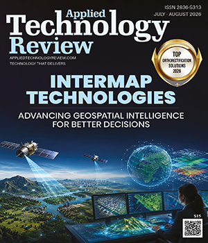
¬Reliable geospatial intelligence is essential for infrastructure planning, asset management and operational decisions. As organizations seek greater accuracy and faster access to actionable data, this edition of Applied Technology Review explores the cutting-edge technologies and skillsets revolutionizing the capture, analysis and utilization of location data for industry stakeholders.
Leading this edition is Intermap Technologies, recognized as the Top Orthorectification Solutions 2026. Orthorectification of images, the use of unique elevations and spatial processes have been enhanced by this firm to provide intelligence about the geographical accuracy of an area for the purpose of infrastructure planning, disaster response and risk assessment. By building on reliable spatial foundation platforms that foster collaboration and minimize uncertainties, Intermap helps organizations make sound decisions.
Also featured is Basemap Consulting, named the LiDAR Mapping Solutions of the Year 2026. This firm has gained a name for its ability to combine drones, LiDAR surveys and geographic data collection methods to deliver speedy, highly accurate datasets that are required for infrastructure, renewable energy and construction projects. The firm focuses on delivering the datasets quickly and effectively, and putting into practice how geospatial data can speed up projects.
Tracey Foster Milton, Director of GIS and Asset Management at Waggoner Engineering, illustrates how GIS helps build utility infrastructure via better asset management, increased efficiency, better responses to emergencies and collaboration among different groups. Chris Garrow, Gaming Operations Director at Prairie Band Casino & Resort, offers an insider’s perspective on the evolving U.S. gaming landscape, emphasizing regulatory complexity, responsible operations and the importance of player development in building sustainable casino performance.
All of these elements highlight the impact that advanced geospatial technology and knowledgeable leadership are having on improved performance throughout a wide range of industries. We invite you to explore this edition and discover how today’s innovators are transforming data into confident decisions and measurable outcomes.
Top
